Burton Cooperative Residence
Botanical Landscape 3D Modeling
- 3D spatial modeling
- Environmental design
- Experience design
- Architectural planning
- Public-private Infrastructure
Overview
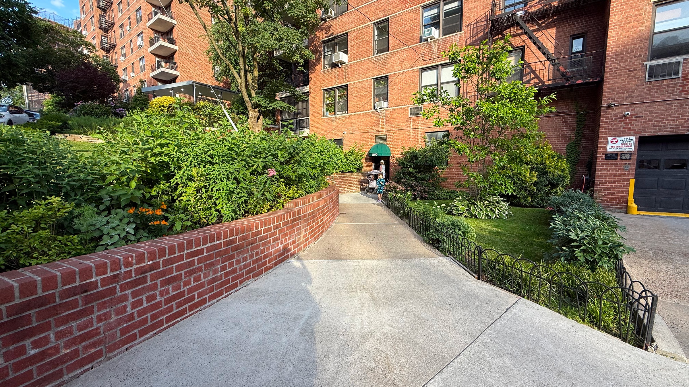
The Burton Cooperative's goal was to synthesizing resident feedback into a precise, functional landscape design that anchors a topographically sensitive urban incline while complying with city regulations and maintaining aesthetics in a high traffic area.
Challenge
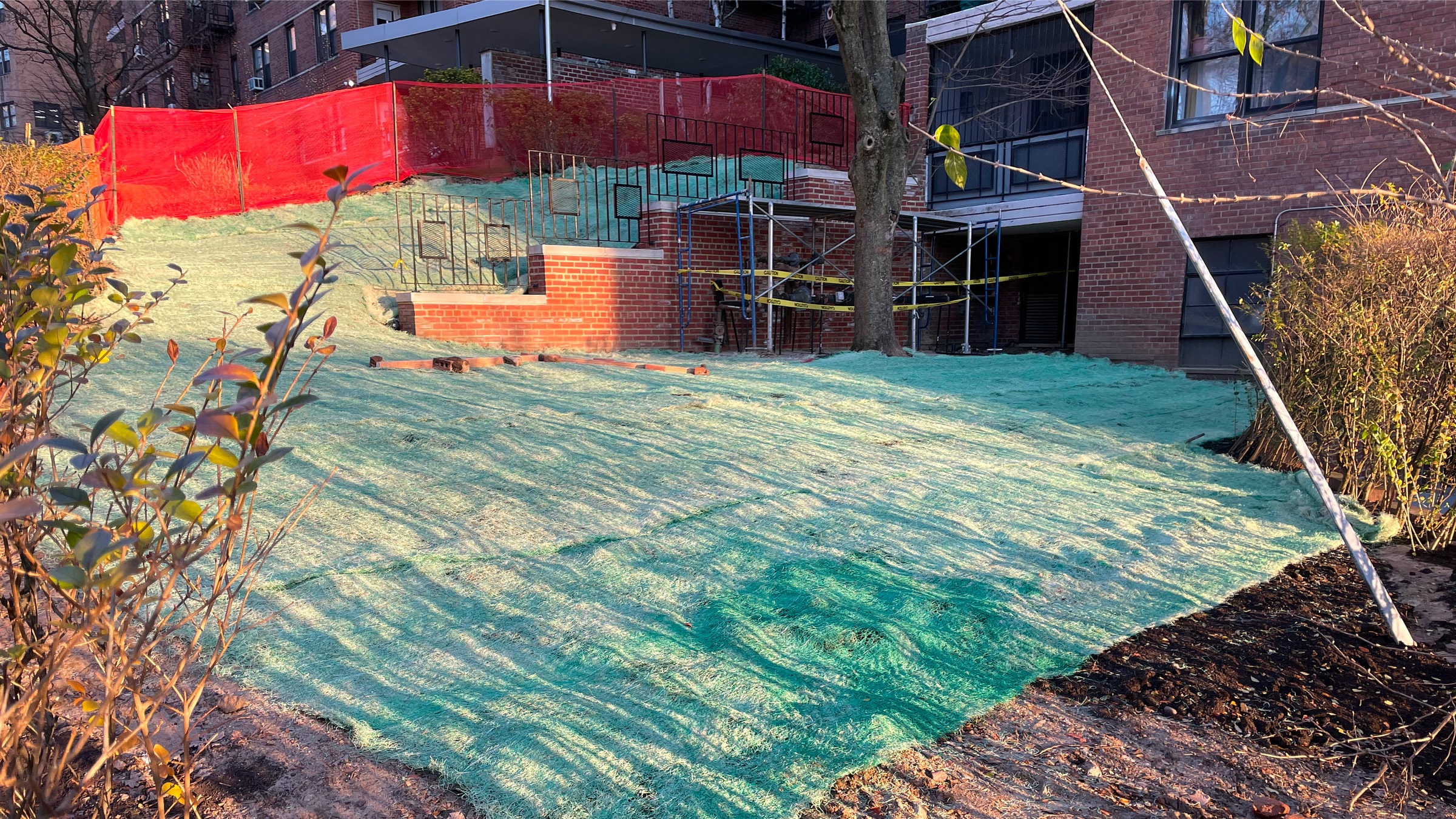
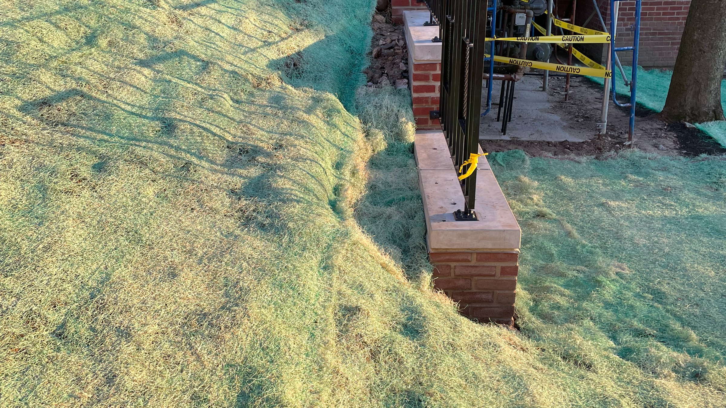
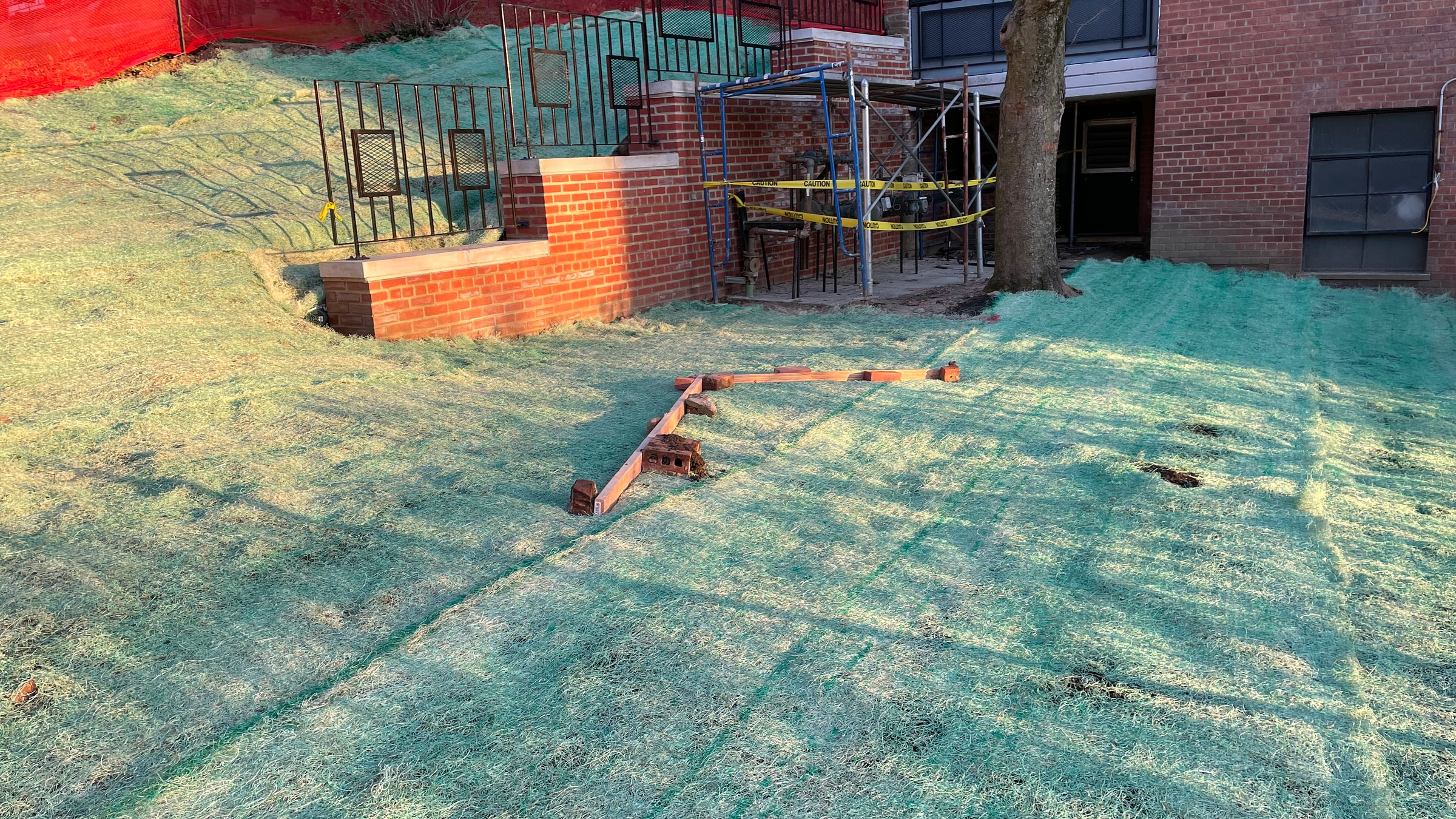
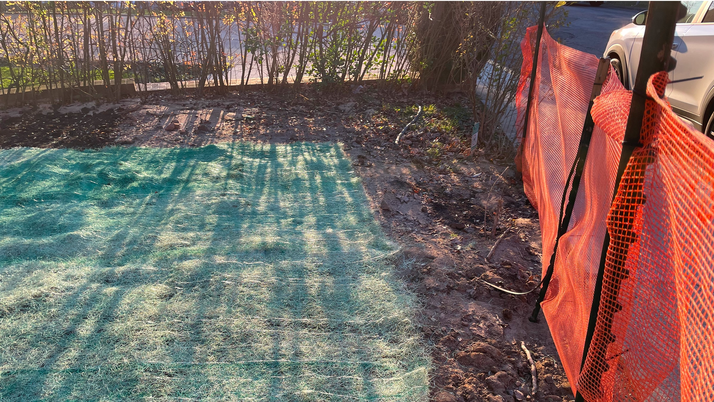
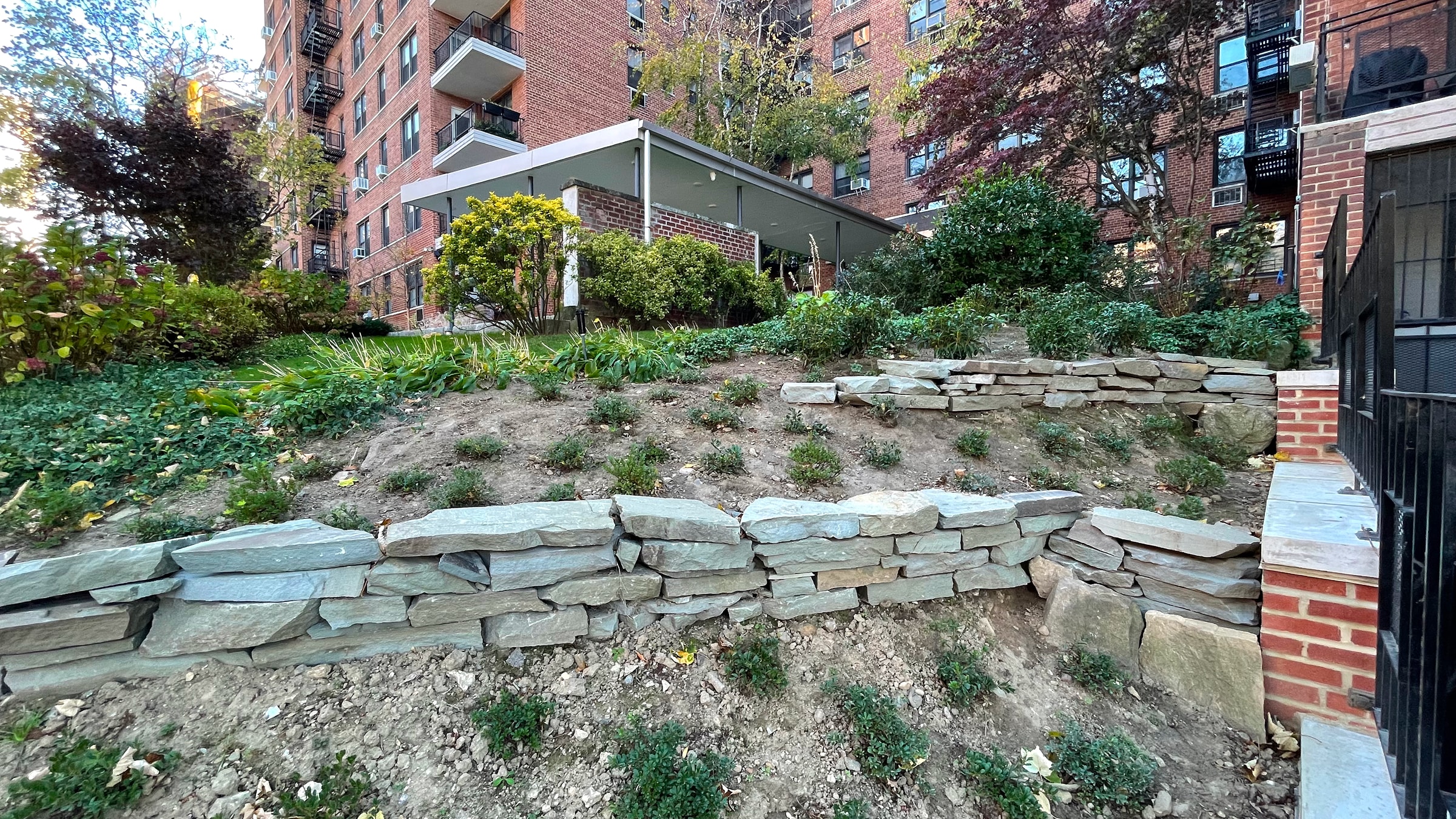
Following a retaining wall update, residents requested the removal of invasive plant species and favored native plantings for the front landscaping reconstruction. Cross-disciplinary project management exposed vendor issues: an engineering firm underestimated stormwater runoff, and a landscaping crew deployed inadequate stone barriers and immature flora. These failures accelerated topsoil erosion and threatened existing structures.
Solution
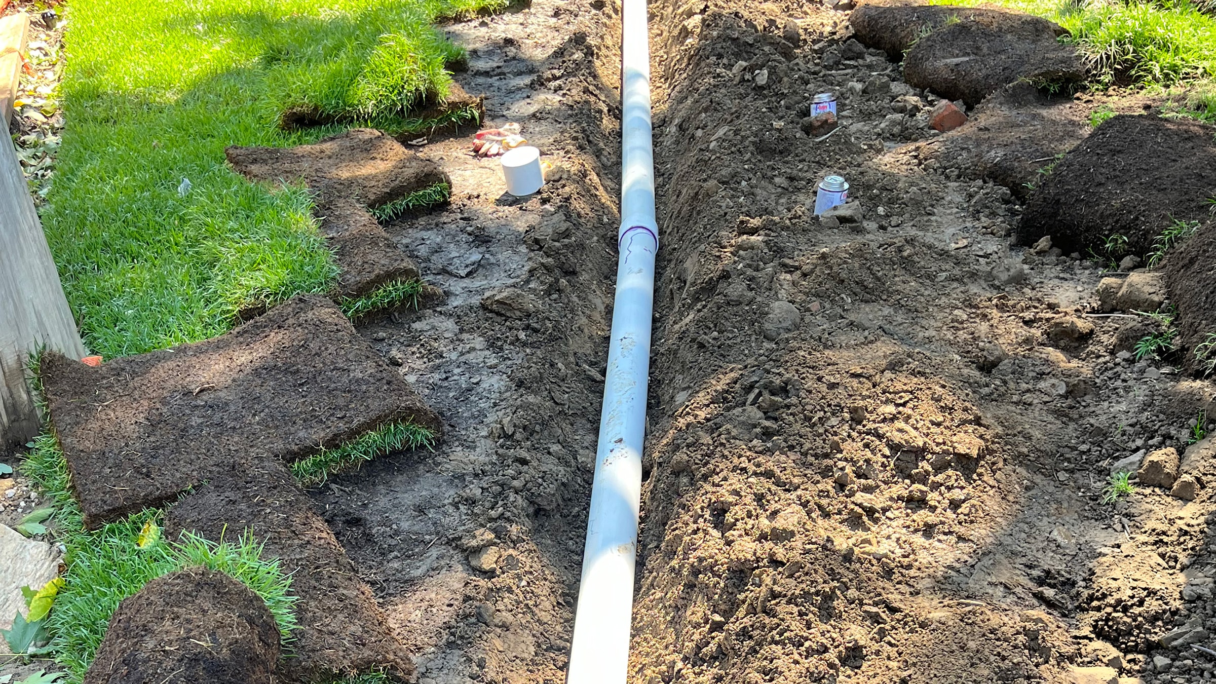
Designed a landscaping model to simulate placement of native pollinator-attracting plantings and coordinated an auxiliary contractor to engineer a subsurface drainage pipeline. This structural correction mitigated the erosion problem while establishing natural irrigation support that recycled diverted water runoff to nourish the lower lawn plantings.
Role
I was the sole designer on this project, supporting building management agents, co-op board leadership, and residential committee members. I collaborated with civil engineers, construction contractors, and landscaping crews.
01 / Topography & Compliance Challenges
Analyzed variable-grade property frontage to identify soil erosion liabilities and municipal drainage code affecting a high-traffic pedestrian corridor. Discovered core layout challenge lay in executing a high-density environmental design that could capture and filter immense volumes of water on-site without sacrificing the goal of increasing native plantings and improving co-op aesthetics.
Topographical Grade Analysis
Recorded severity of slopes to identify primary runoff pathways and structural weak points prone to erosion or saturation.
Drainage Regulation Compliance
Reviewed engineers' interpretation of municipal drainage codes to understand design constraints pertaining to on-site water retention and corridor diversion.
Public-Private Spatial Balancing
Managed the intersection of secure private residential landscape architecture and accessible public infrastructure.
02 / Technical Drafting & Hardscape Layout
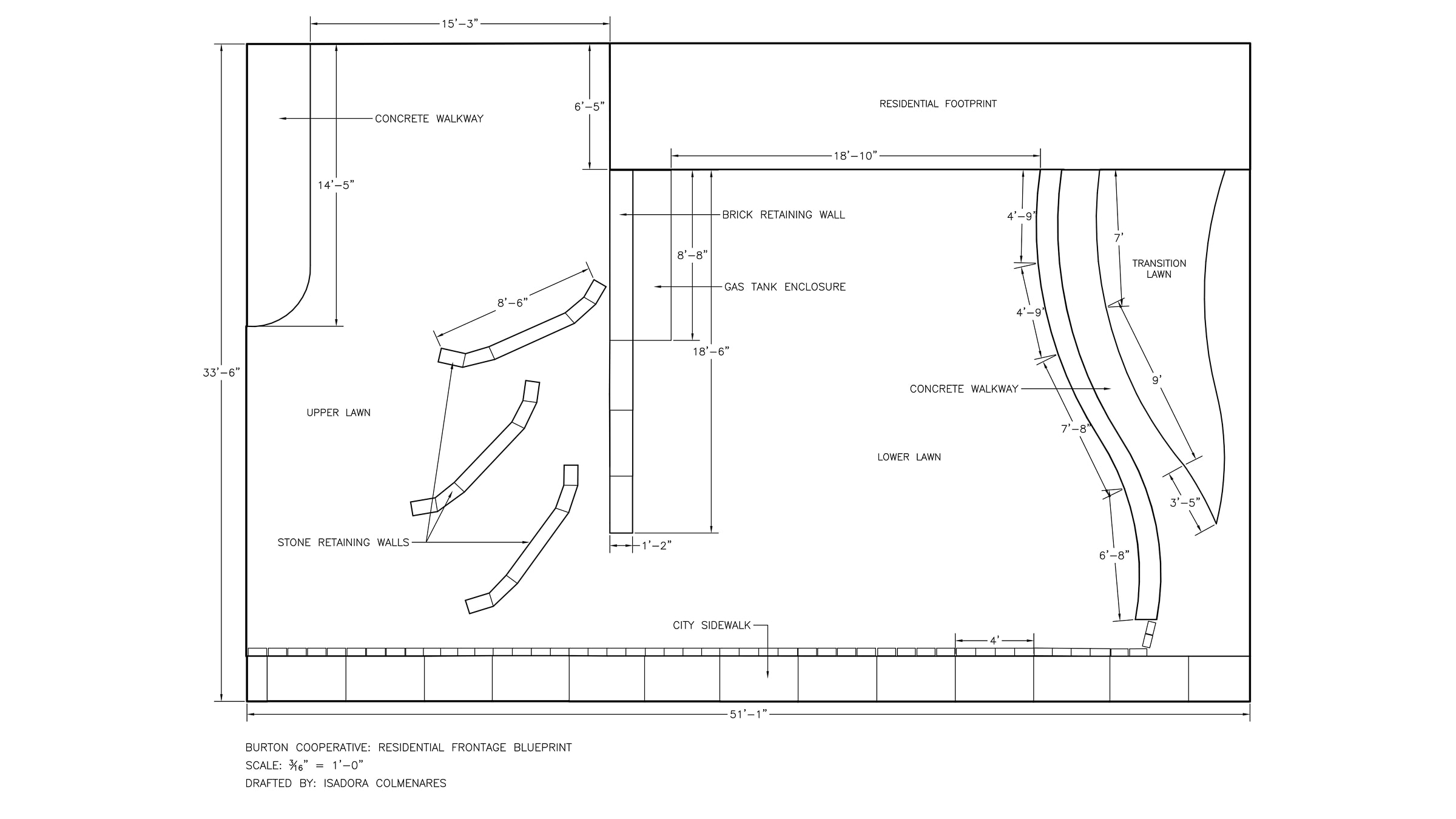
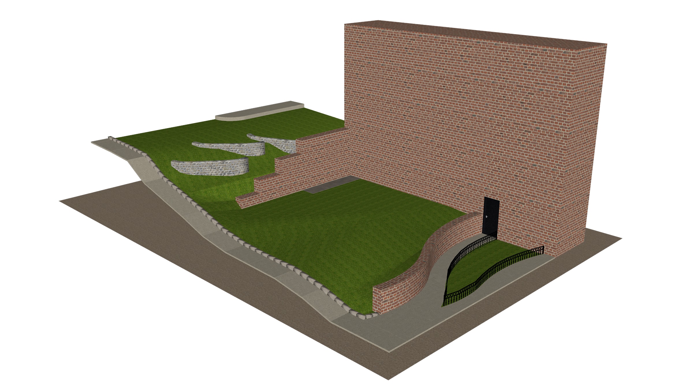
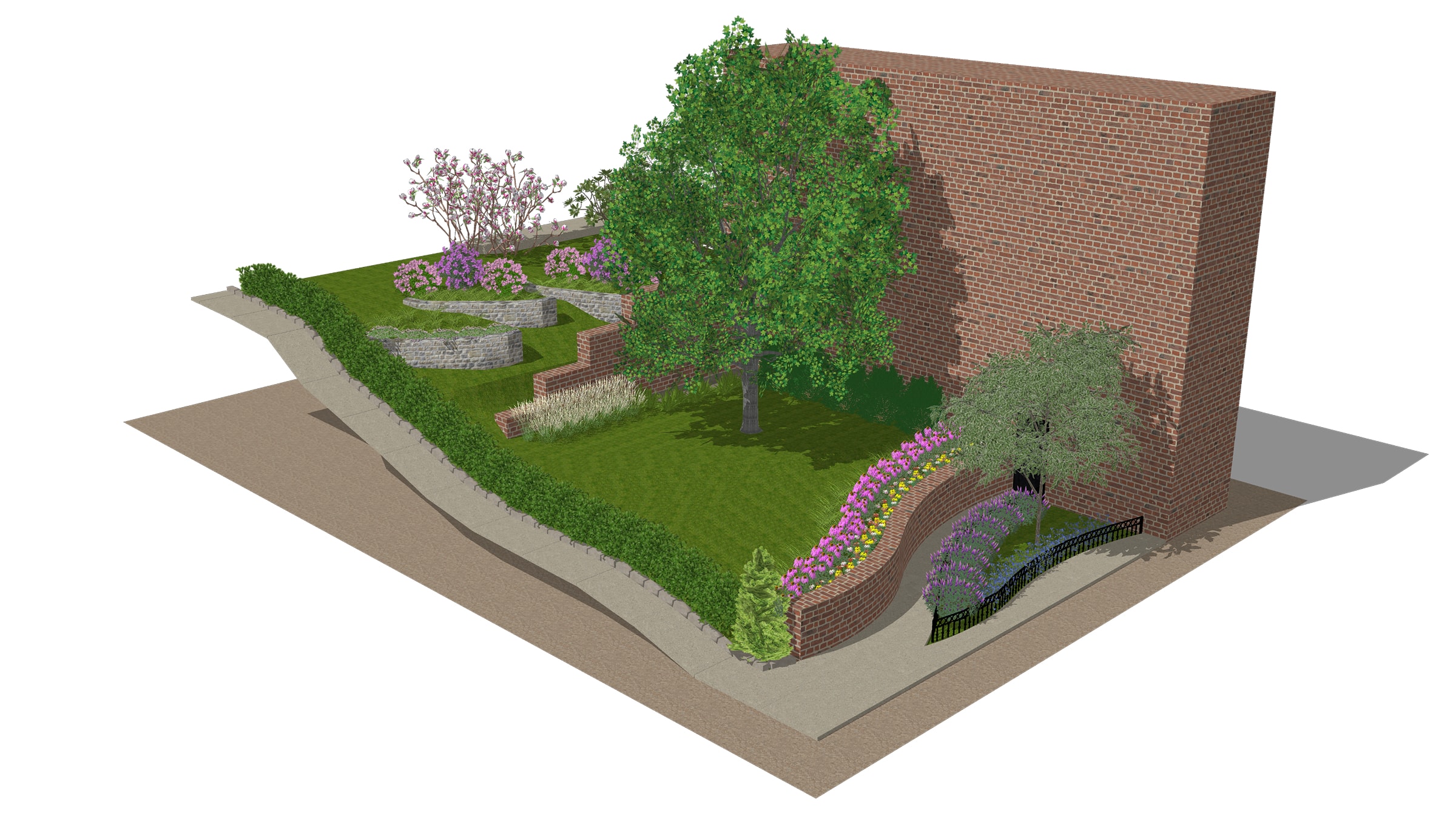
Translated site measurements into precise 2D AutoCAD vector blueprints to establish spatial boundaries and hardscape architecture. Used SketchUp environment to build out the volumetric hardscape profiles, visualizing 3D structures and multi-tiered lawn geometries required to determine planting zones.
Flat Vector Foundation (AutoCAD)
Drafted master top-view technical plans detailing exact property lines, public pedestrian right-of-ways, and core structural footprints to secure a precise baseline.
Volumetric Hardscape Modeling (SketchUp)
Extruded 2D geometric layouts into high-fidelity 3D structural masses, modeling the exact physical scale, depth, and stepped positioning of the stone retaining walls.
Cross-Platform Spatial Alignment
Managed a seamless data pipeline between AutoCAD DWG files and SketchUp viewports to ensure 2D site grading contours perfectly mapped onto 3D terrain manipulations, leaving zero margin for structural error.
03 / Planting Simulation & 3D Spatial Modeling
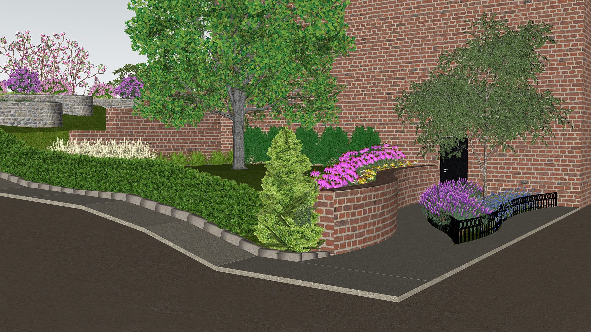
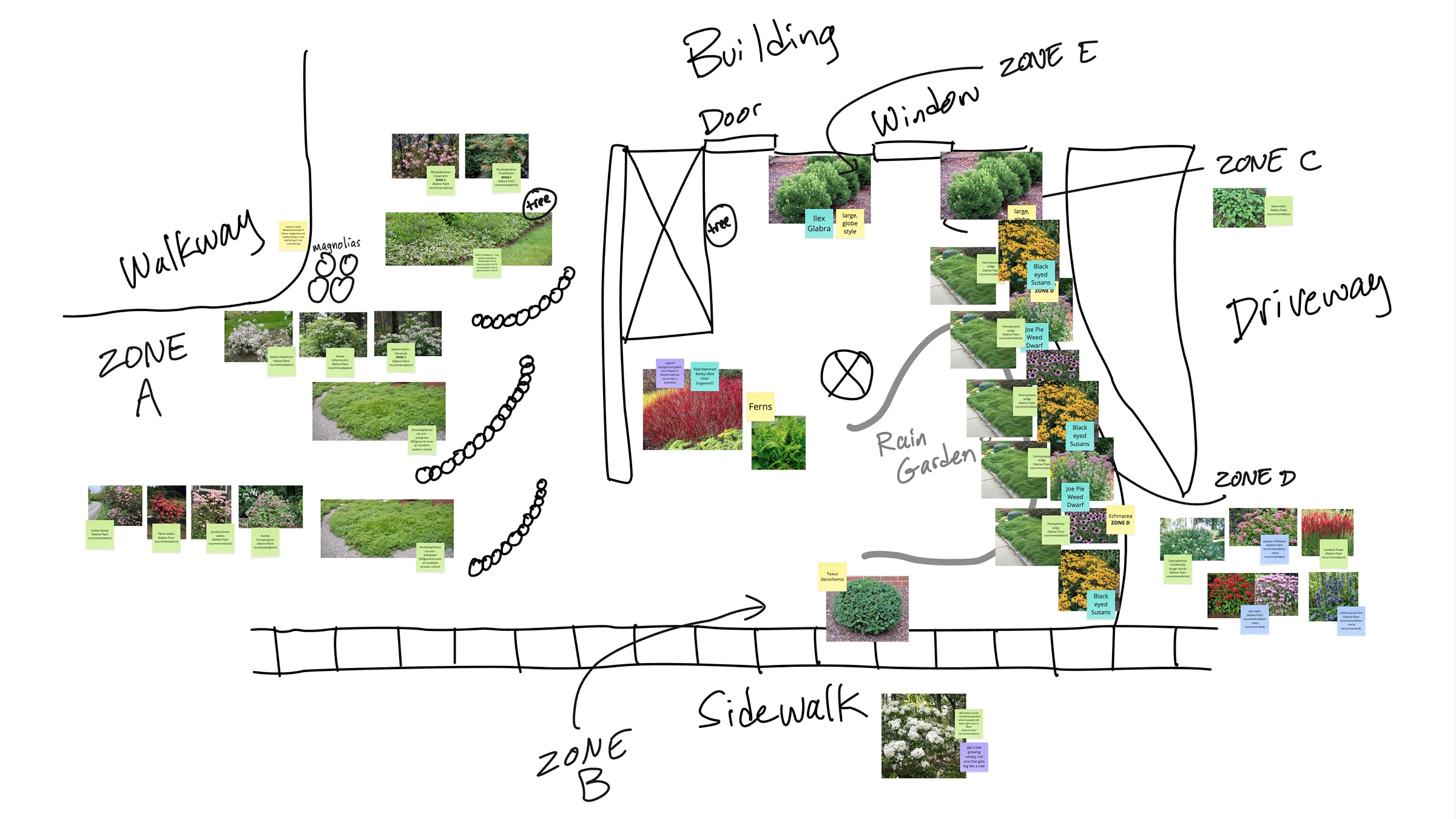
Translated qualitative co-op resident feedback into hand-drawn sketches and 3D models to establish planting zones, targeting native species to support local pollinator populations. Used SketchUp to model volumetric soil gradients and visualize plant canopies and lower floral tiers, ensuring sustainable growth and erosion control.
Collaborative Flora Mapping
Synthesized qualitative resident input and obtained botanist review of native planting list to cross-reference species selections with regional soil-stabilization performance metrics.
Rapid Ideation of Spatial Layouts
Executed freehand site sketches and conceptual overlays during stakeholder workshops to rapidly iterate zone assignments, mapping out species distribution relative to microclimate exposure and shade profiles.
Volumetric Terrain & Growth Simulation
Sculpted the steep, variable-grade frontage within SketchUp to model volumetric soil configurations and simulate multi-year plant canopy growth, validating long-term aesthetic transformation.
04 / Civil Mitigation & Hydrological Infrastructure Engineering
Discovered structural engineering errors in runoff routing and led an auxiliary contractor to install a subsurface drainage pipe. This structural correction mitigated the slope erosion threat while establishing a sustainable, natural resource system to passively irrigate the lower lawn plantings.
Erosion Stabilization
Identified issue with plantings intended to support erosion control due to sparsity of installation and lack of root system maturity.
Complex Runoff Patterns
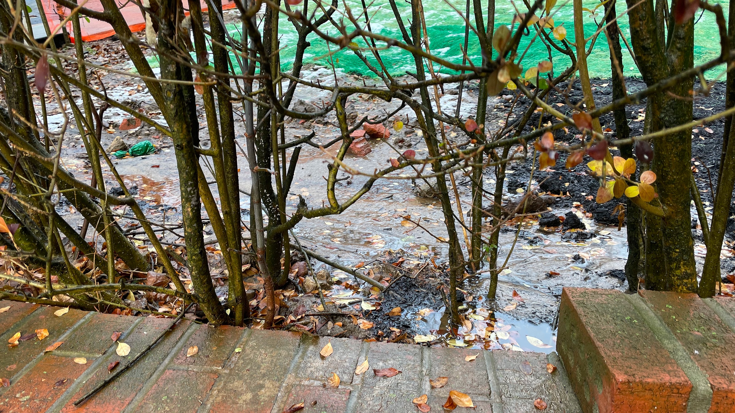
Documented water runoff across multiple on-site visits in inclement weather to capture evidence of storm effects.
Subsurface Hydrological Routing
Collaborated on a subterranean drainage network and piping infrastructure to channel runoff away from residential foundations and public walkways.
05 / Solution and Functional Outcomes
Delivered a regulation-compliant, community-centric landscape design pairing hard retaining barriers with localized botanical zoning. The solution secured the eroding frontage while repurposing water runoff into a natural irrigation asset that sustained the lower lawn ecosystem and enhanced co-op aesthetics.
Resident-Requested Native Plantings
Created an elegant stepped landscape that supports a wide variety of pollinator-attracting native plantings and offers an aesthetically pleasing experience for residents, visitors, and passers-by.
On-Site Precipitation Capture
Diverted 100% of surface runoff away from municipal sidewalks and back into native soil ecosystems.
Visual-Technical Documentation
AutoCAD drafting and SketchUp modeling serve as references for future planning and upgrades.